2024/25
MAGNA refers to the broad, omniscient, and distant gaze that encompasses everything from above. The images that make up this project are part of “Land,” an ongoing work initiated in 2012, aimed at developing a World Atlas composed of maps of areas where natural resources are extracted. The images in the project are constructed based on screenshots from Google Earth, printed in large size and high definition. They are satellite cartographies that reveal the topographies of sacrifice zones, fields of extraction for silver, gold, copper, oil, and lithium in Argentina’s most productive areas, uncovering the historical evolution of the landscape, the political construction of territory, and our geopolitical identity.
The omnipresence of the digital gaze over our planet has created a new form of colonialism: one that operates through pixels and satellite data. Land reveals the scars that global extractivism has left on our landscapes, documented by the incessant eye of satellite surveillance technologies.
As a female artist committed to the intersection of technology and the environment, my work seeks to expose the paradox of our era: the more tools we have to observe the devastation of our planet, the more we normalize its systematic destruction.
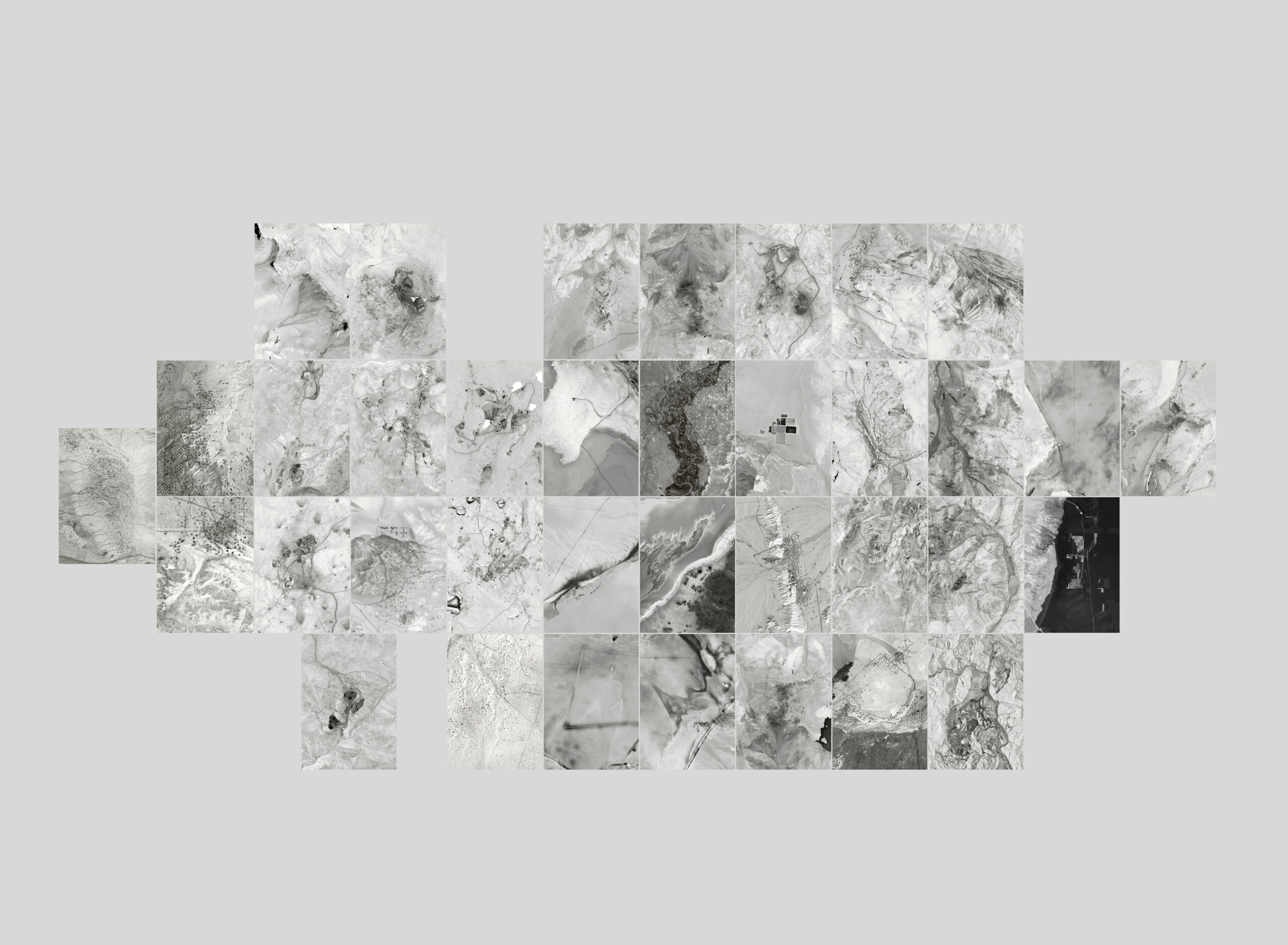
Mosaic of argentinian mines. 2024.
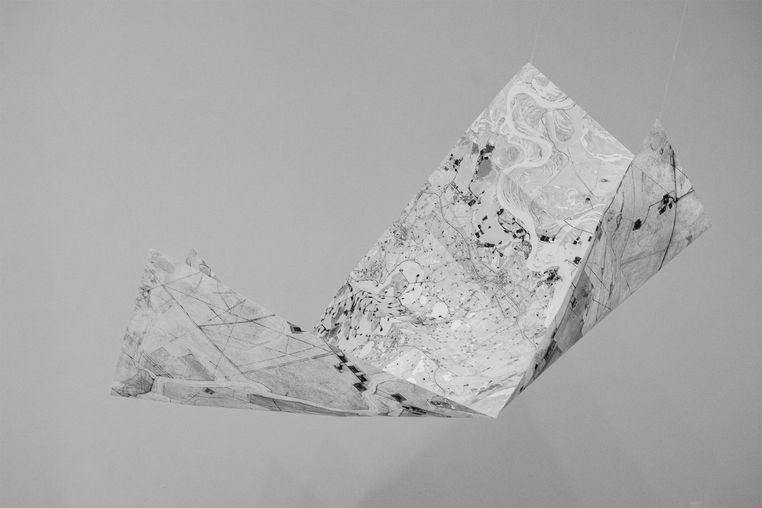
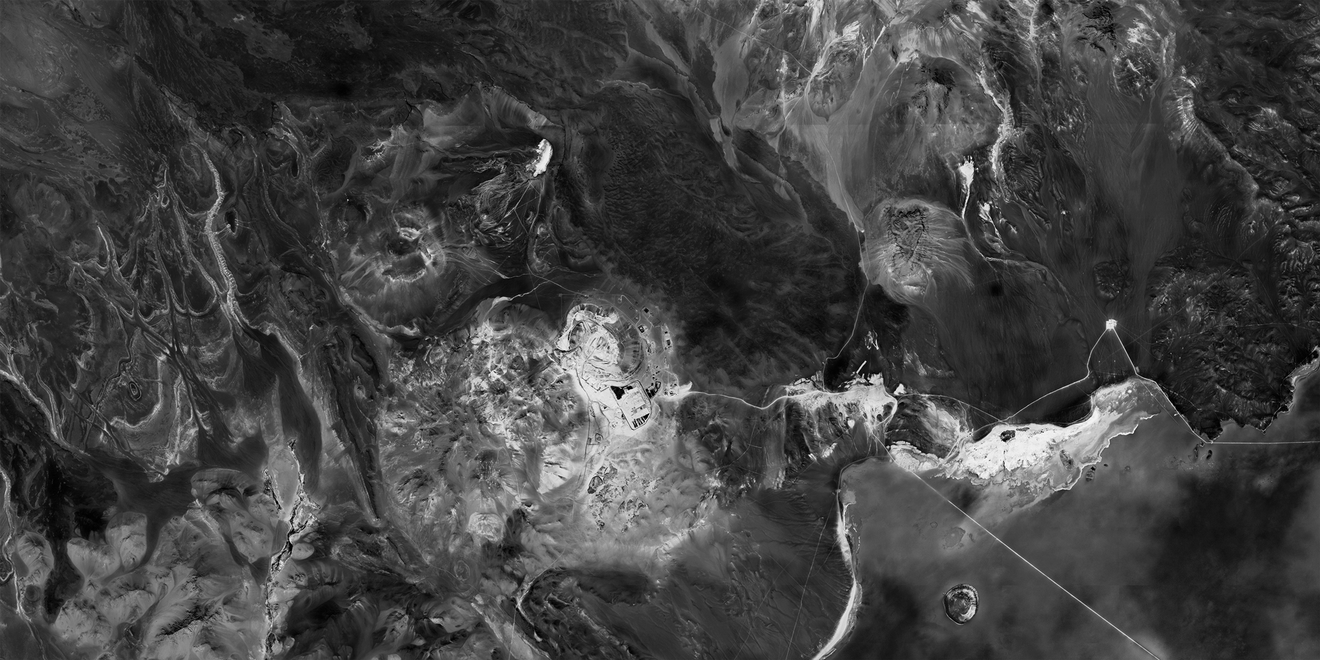
flying Oil. 2024.

Oil. 45º52’5.13″S | 67 52’5.29″O | 17 Oct 2013 | Printed on Canson Baryta | 2014 | Print max size: 330 por 230 cm. *

Oil. 38º4’8.34″S | 67º49’16.56″O | 14 Ene 2012 | Printed on Canson Baryta | Print max size: 160 por 68cm.

oil. 45º47’13.47″S | 68º3’45.55″O | 30 dic 2005 | 2013 | Printed on Canson Baryta |Print max size: 105 por 135
cm.

Oil.33º10’18.78″S | 68 46’8.18″O | 4 Sep 2004 | 2012. Printed on Canson Baryta |Print max size: 300x150cm
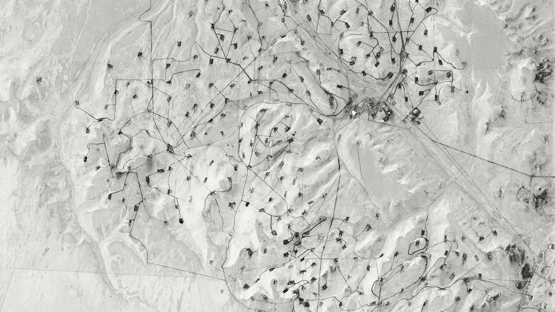
45°35’12.26″S | 67°46’10.77″O| | 27 May 2012 | 2013 | Printed on Canson Baryta | Print max size: 220 por 110 cm

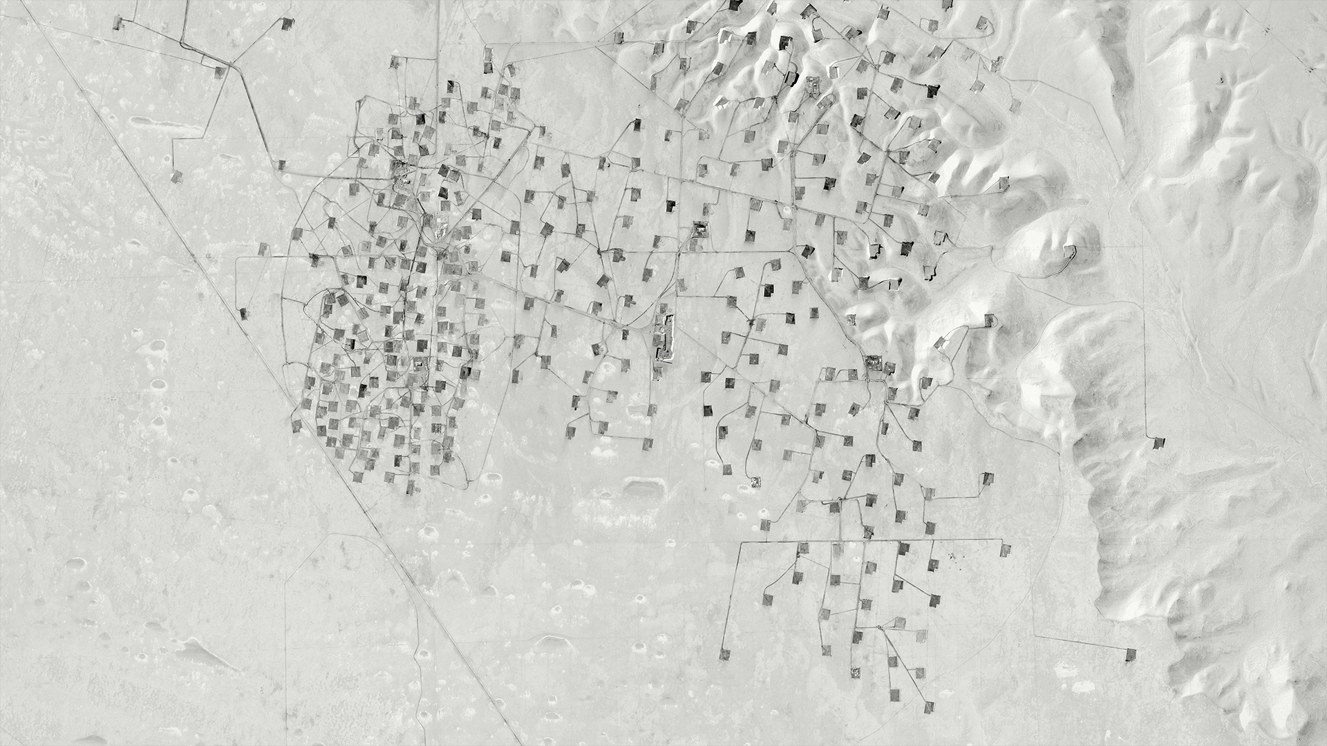
32°23′ N | 102°26’O | Oct 4, 2014 | Max print size: 230 x 160 cm.
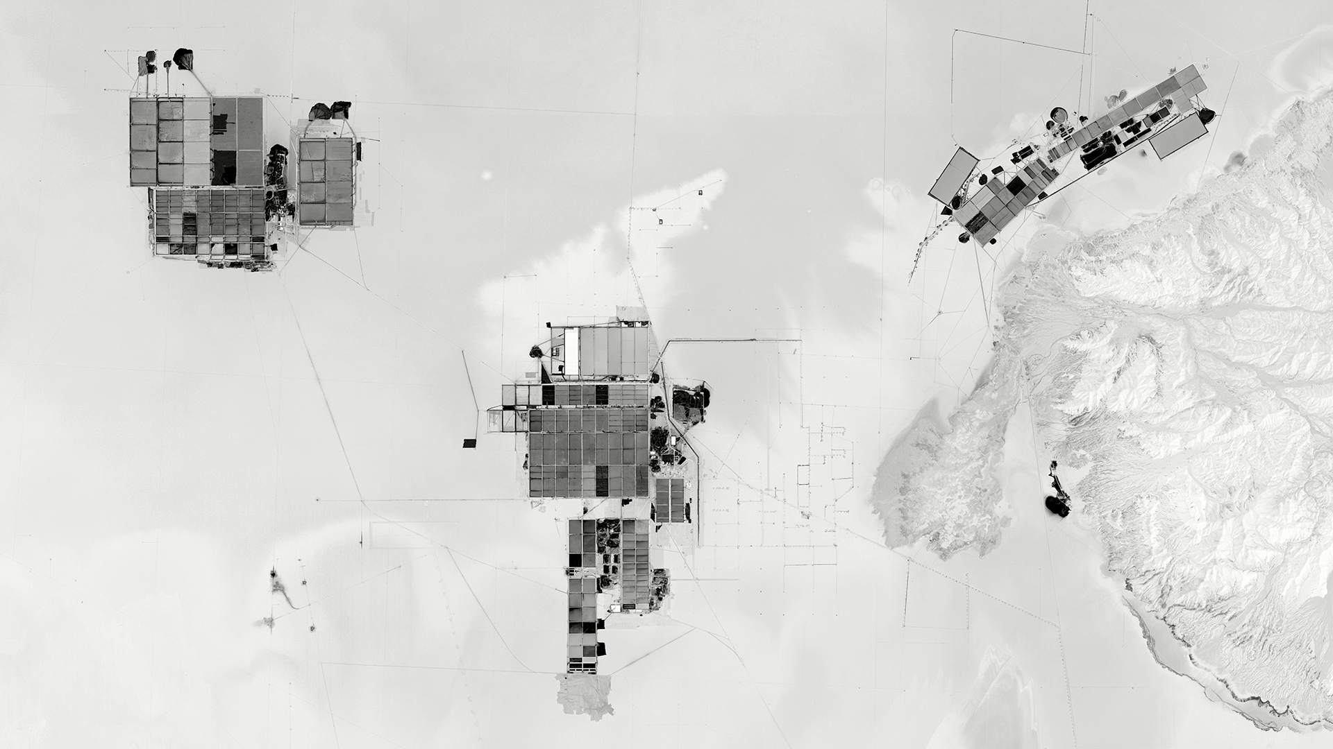
Chile, Salar de Atacama 3.1, 23°32’54.24″S 68°23’29.03″O, 7 Feb 2017. 2021. 300x150cm
Chile, Salar de Atacama 3.1, 23°32’54.24″S 68°23’29.03″O, 7 Feb 2017. 2021.

Chile, Salar de Atacama 3.1, 23°32’54.24″S 68°23’29.03″O, 7 Feb 2017. 2021.
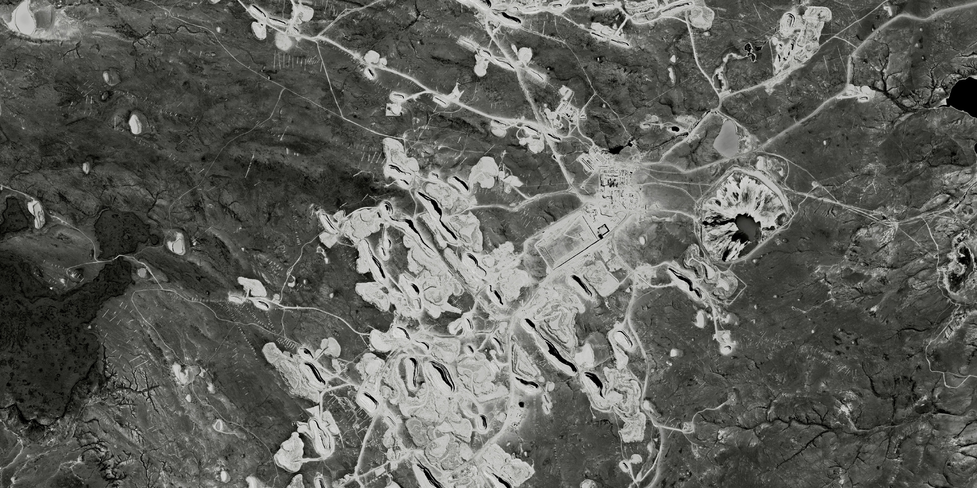
ORO. Argentina. Cerro vanguardia. 2024. 300x150cm
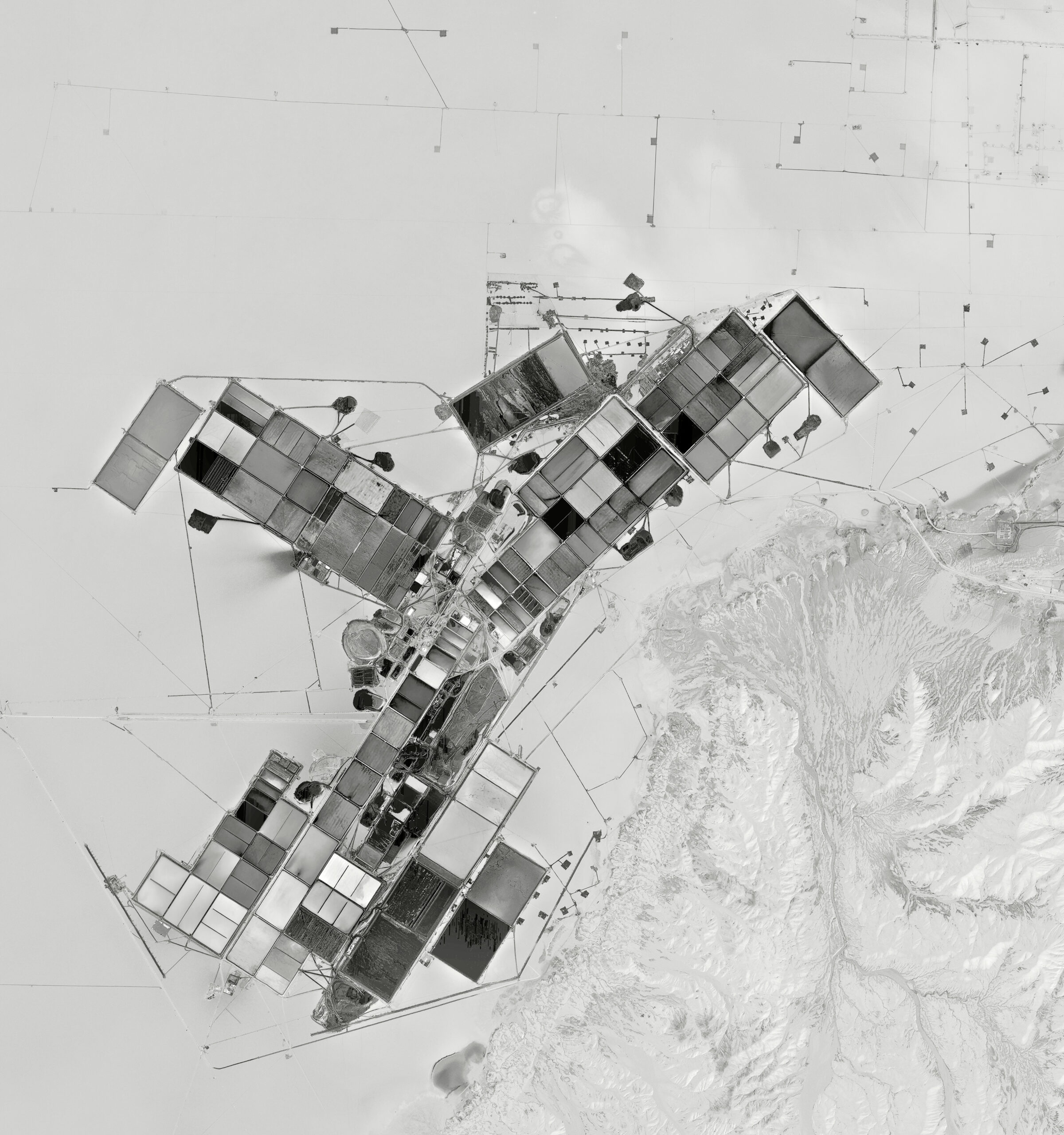
LITIO Y ORO. Salar de Arizaro y Proyecto Lindero. 25°06’00.0″S 67°45’00.0″O. 2024. 300x150cm