
38º4’8.34″S | 67º49’16.56″O | 14 Ene 2012 | Printed on Canson Baryta | Print max size: 160 por 68cm.

37°16’55.73″S | 69°15’55.68″O | 11 Ene 2006 | 2013. *

37º55’31.22″S | 67º48’30.04″O | 17 Sep 2013 | Printed on Canson Baryta | Print max size: 195 por 250 cm.

46°37’38.01″S | 67°55’35.03″O. | Printed on Canson Baryta | Print max size: 200 por 130cm. *
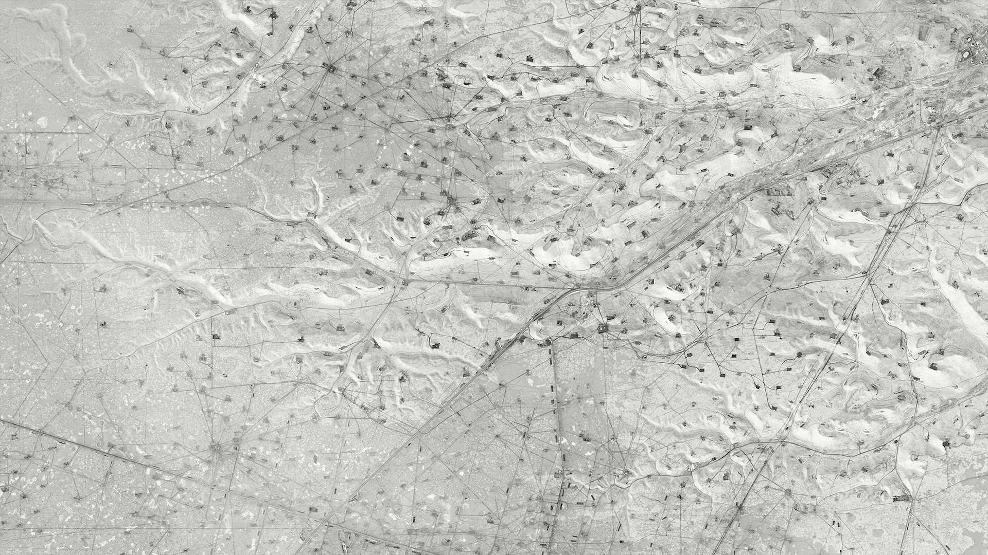
45º45’22.84″S | 67º41’7.01″O 17 Oct 2013 | Printed on Canson Baryta | Print max size: 200 por 130cm. *

Oil. 45º52’5.13″S | 67 52’5.29″O | 17 Oct 2013 | Printed on Canson Baryta | 2014 | Print max size: 330 por 230 cm. *

45º45’22.84″S | 67º41’7.01″O | 17 Oct 2013 | Printed on Canson Baryta | Print max size: 200 por 130cm. *
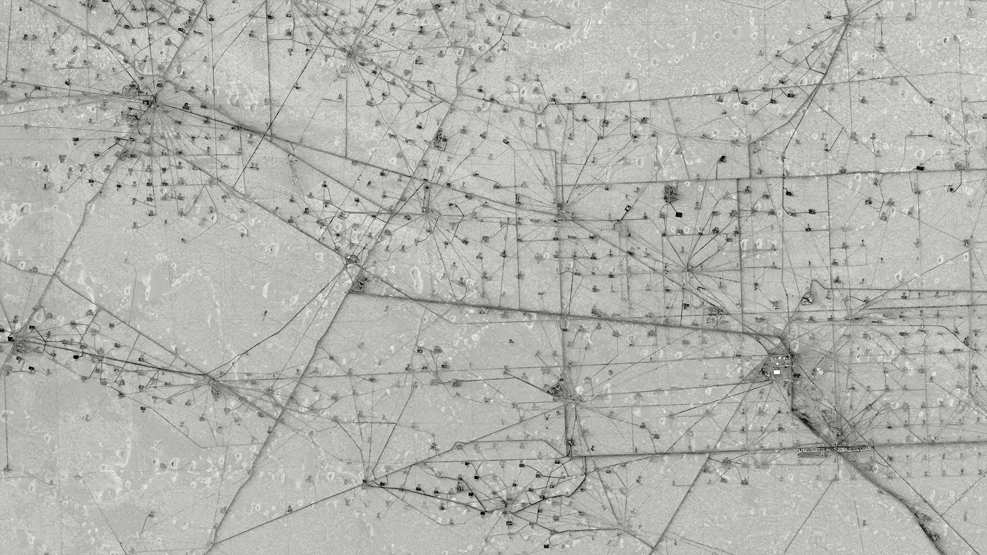
46º37’38.01″S | 67º55’35.03″O | 9 Mar 2009 | Printed on Canson Baryta | Print max size: 270 por 250 cm. *

22º9’54.06″S | 63º36’29.45″O | 1 Sep 2011 | Printed on Canson Baryta | Print max size: 225 por 154 cm. *
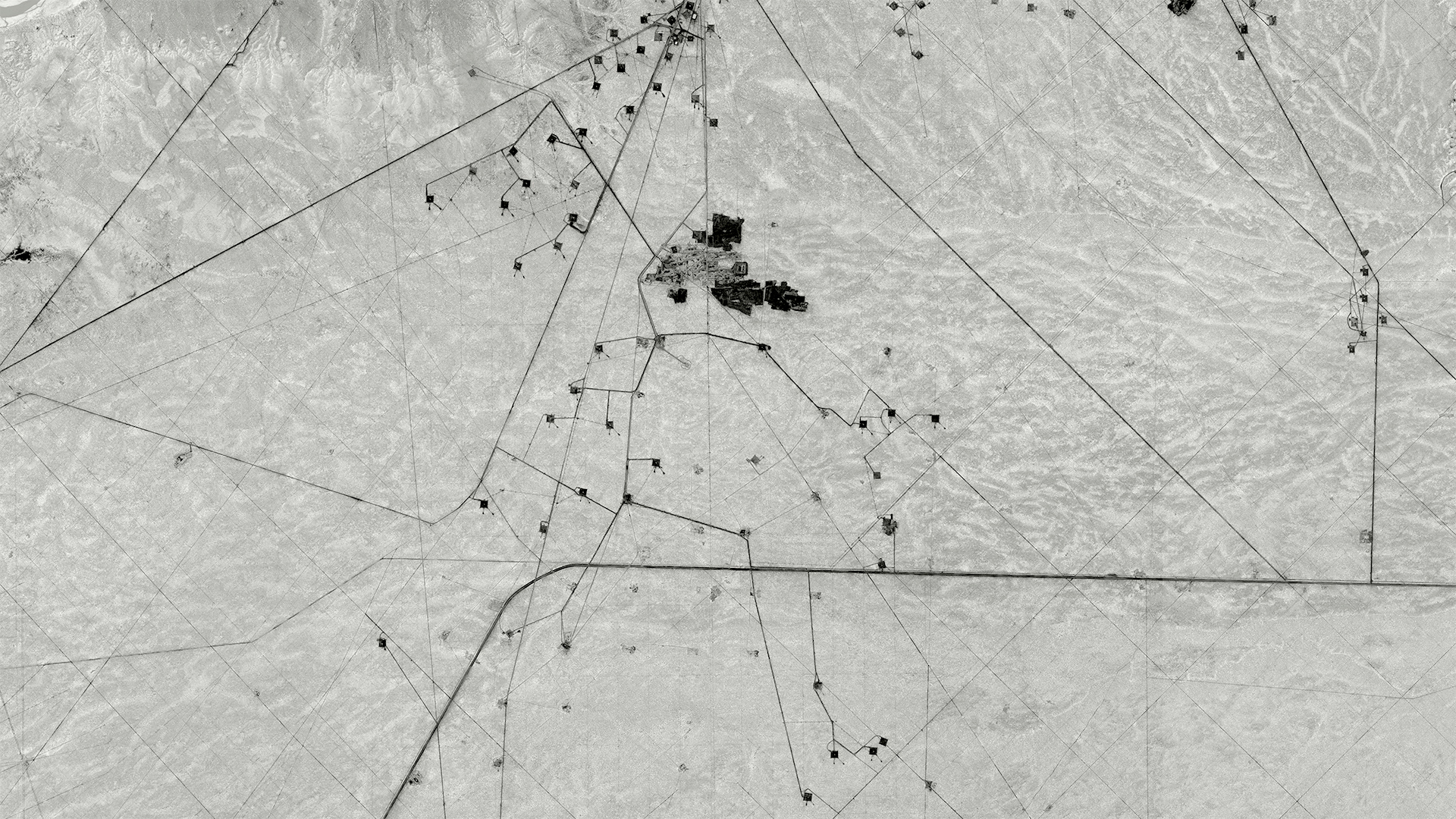
38° 1’0.59″S | 67°41’43.01″O | 17 Sep 2013 | Printed on Canson Baryta | Print max size: 195 por 250 cm. Printed on Canson Baryta | Print max size: 195 por 250 cm. *G

45º47’13.47″S | 68º3’45.55″O | 30 dic 2005 | 2013 | Printed on Canson Baryta | Print max size: 105 por 135 cm. *

38°10’9.89″S | 68°7’40.52″O | 28 Sep 2006 | 2013 | Printed on Canson Baryta | Print max size: 160 por 195 cm.

37°18’48.32″S | 68°55’51.80″O | 18 Sep 2013 | Printed on Canson Baryta | Print max size: 110 por 90 cm. *

37°19’17.61″S | 69° 4’31.93″O | 7 Sep 2010 | 2013 | Printed on Canson Baryta | Print max size: 220 por 130 cm. *G
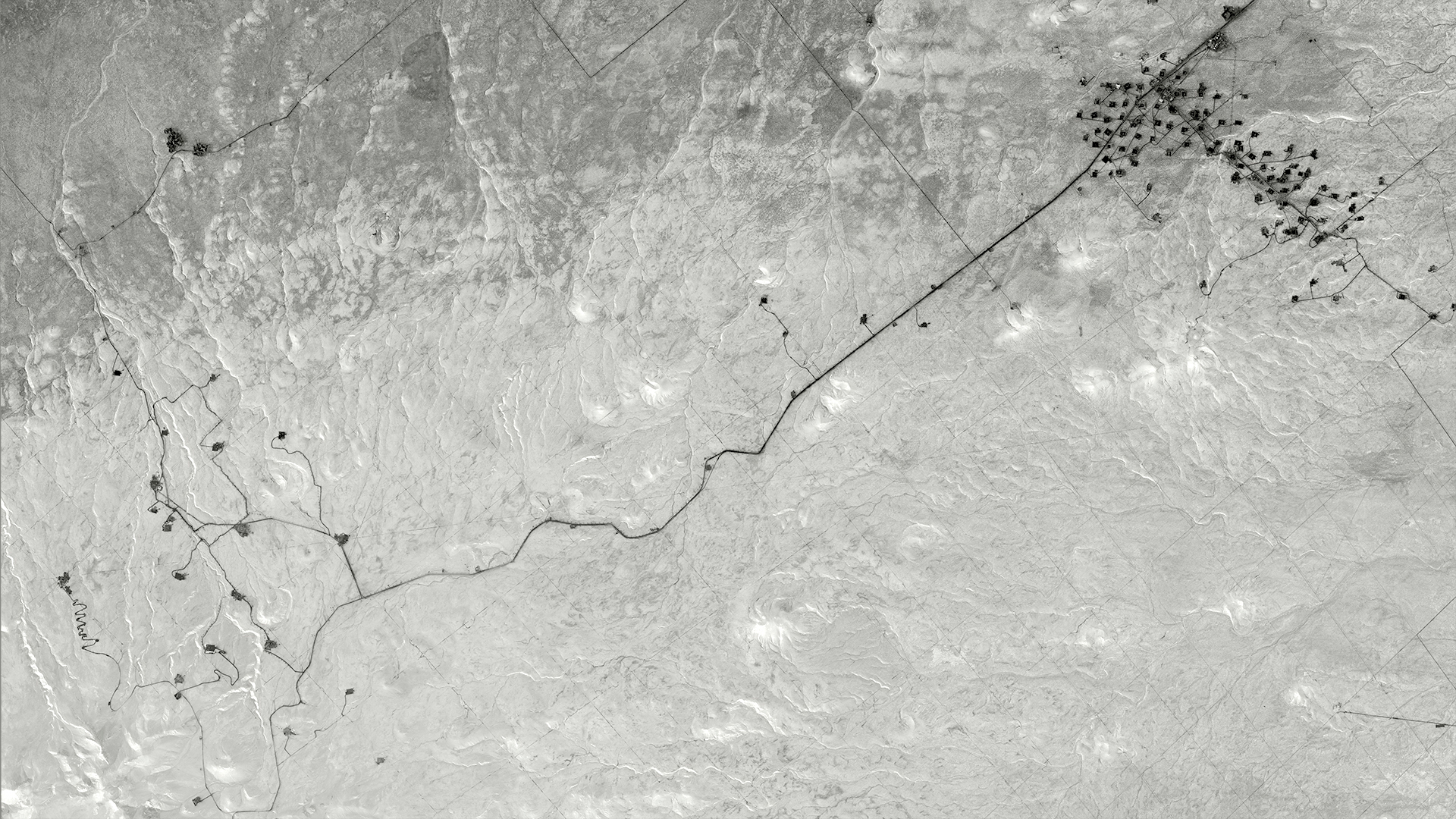
37°39’6.08″S | 68°48’40.73″O | 7 Sep 2010 | Printed on Canson Baryta | Print max size: 270 por 250 cm.

33°10’18.78″S | 68°46’8.18″O | 4 Sep 2004 | Printed on Canson Baryta | Print max size: 220 por 110 cm

33º10’18.78″S | 68 46’8.18″O | 4 Sep 2004 | 2012. *
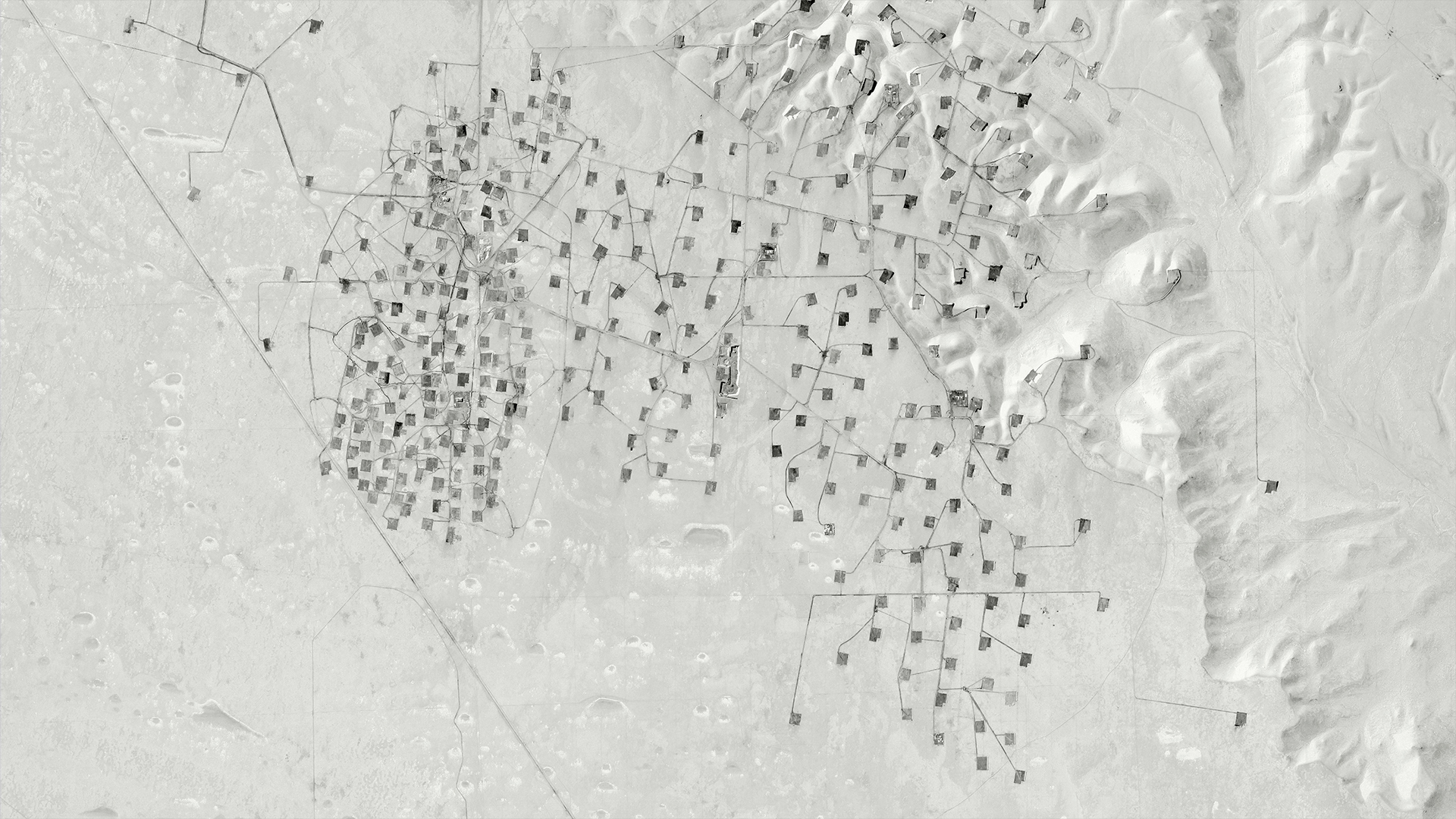
45°35’12.26″S | 67°46’10.77″O| | 27 May 2012 | 2013 | Printed on Canson Baryta | Print max size: 220 por 110 cm. *

32°23′ N | 102°26’O | Oct 4, 2014 | Max print size: 230 x 160 cm. *

32°15’N | 102°43′”O | Feb 13, 2014. | Max print size: 230 x 160 cm. *
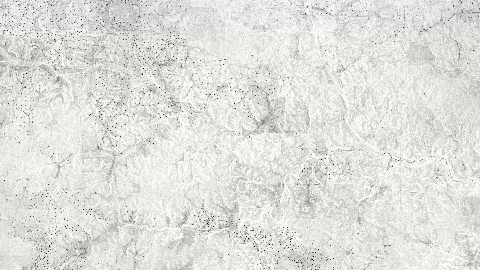
30º21’N | 101º5’O | Nov 22, 2014 | Printed on Canson Baryta | Max print size: 230 x 160 cm. *
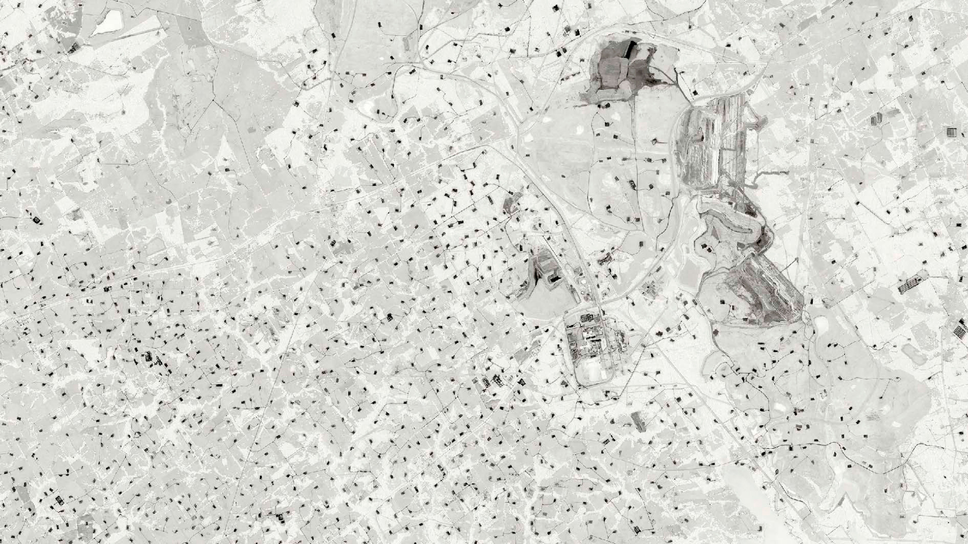
31°25’N | 96°16’O | Nov 31, 2014 | Max print size: 230 x 160 cm. *
2012 | OIL
ES
Un río de meandros cruza la imagen en grises y, sobre la meseta, decenas de puntos blancos se unen por rectas finas: locaciones de pozos, caminos y picadas abiertos en el territorio. El petróleo no está en la imagen; está bajo tierra. Oil registra el diagrama que la industria inscribe sobre su superficie.
Esta serie comenzó en el golfo San Jorge, con el hallazgo en Google Earth de pozos que desde el suelo permanecían invisibles. Reúne mapas de yacimientos de la Argentina y de Texas, armados a mano con capturas de pantalla y titulados con sus coordenadas exactas y con dos fechas: la de la imagen publicada y la de su ensamblado.
La mirada satelital reedita la ficción que la Campaña del Desierto produjo a fines del siglo XIX: un territorio vacío sobre tierras habitadas, abierto al capital.
Desde las ovejas de las grandes estancias laneras hasta el petróleo y los recursos minerales del presente.
El satélite no es solo una herramienta de registro: es el aparato que consuma y evidencia esa mirada extractiva, el ojo que permite ver el territorio como campo de extracción.
OIL (2012). Mapas de campos petroleros de la Argentina y de Texas, ensamblados a mano a partir de capturas de pantalla de Google Earth. Inkjet sobre Canson Baryta. Medidas variables, hasta 330 × 230 cm. Edición de 5 + 1 P/A. Libro de artista: Land [1] Oil (2017). Colección: Museum of Fine Arts, Houston. Land se exhibió, entre otros espacios, en el Centro Cultural Kirchner (2016), la Guangzhou Image Triennial (2017), Photo Beijing (2019), la 14.ª Bienal de La Habana (2022), Färgfabriken, Estocolmo (2024), y O Mundo Através da IA, Sesc Campinas y Sesc 24 de Maio, São Paulo (2025–2026).
EN
A meandering river crosses the grayscale image, and across the plateau, dozens of white dots are connected by thin straight lines: well locations, roads, and clearings cut into the terrain. The oil is not in the image; it lies underground. Oi records the diagram that the industry inscribes upon its surface.
This series began in the San Jorge Gulf with the discovery on Google Earth of wells that remained invisible from the ground. It brings together maps of oil fields in Argentina and Texas, manually assembled from screenshots and titled with their exact coordinates and two dates: that of the published image and that of its assembly.
The satellite view reenacts the fiction produced by the Conquest of the Desert at the end of the 19th century: an empty territory over inhabited lands, open to capital. From the sheep of the vast wool estates to the oil and mineral resources of the present, the satellite is not merely a recording tool: it is the apparatus that consummates and evidences this extractivist gaze—the eye that allows the territory to be viewed as a field of extraction.
OIL (2012). Maps of Argentine and Texan oil fields, manually assembled from Google Earth screenshots. Inkjet on Canson Baryta. Variable dimensions, up to 330 × 230 cm. Edition of 5 + 1 AP. Artist’s book: Land [1] Oil (2017). Collection: Museum of Fine Arts, Houston. Land has been exhibited, among other venues, at the Centro Cultural Kirchner (2016), the Guangzhou Image Triennial (2017), Photo Beijing (2019), and the 14th Havana Biennial (2022), Färgfabriken, Stockholm (2024).